In the planning process of action planning within the framework of the URBACT project ECONNECTING, we apply mapping techniques as our key methodology to identify challenges, potentials, and actions. Especially at our large planning scale, it is difficult to identify local actions due to the complexity of the city region and its urban-rural linkages.
I believe that mapping plays a critical role in assessing, analysing, envisioning, and designing concrete actions for the Zero Carbon City Region. Throughout the planning cycle, mapping facilitates dynamic discussions and continuous dialogue among stakeholders, fostering a deeper understanding of towns and settlements within the urban-rural divide. This approach, rooted in integrated urban planning, is especially important in the pursuit of climate neutrality and the identification of place-based investment ideas.
Urban-Rural Linkages and Climate Neutrality
At the regional level, mapping tools provide actionable insights for achieving carbon neutrality by simulating possible future scenarios and visualizing strategy outcomes. These maps identify areas of challenge, opportunity, and growth, enabling informed decision-making and helping policymakers, URBACT Local Group coordinators, and others to prioritize interventions based on geographic evidence.
Just bring it on the map! The visual aspect fosters a shared vision, rallying diverse groups around common climate goals. By simplifying complex policy implications, mapping tools allow decision-makers to communicate strategic priorities without overwhelming detail. This shared understanding is crucial for coordinated action on complex challenges like climate change.
So, how can we do it?
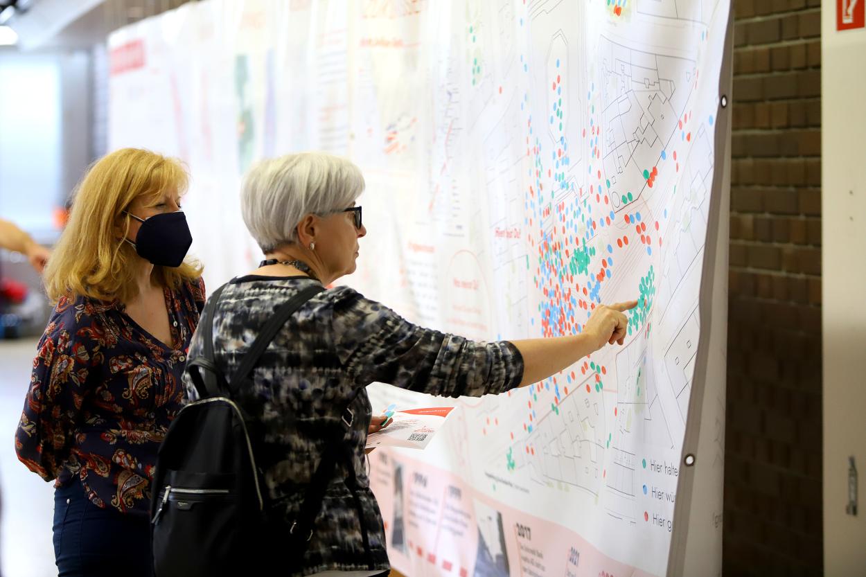
Mapping Can Be Done by Anyone – Just Bring It on the Map
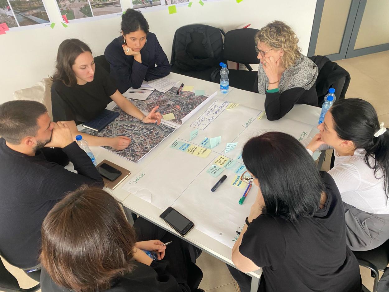
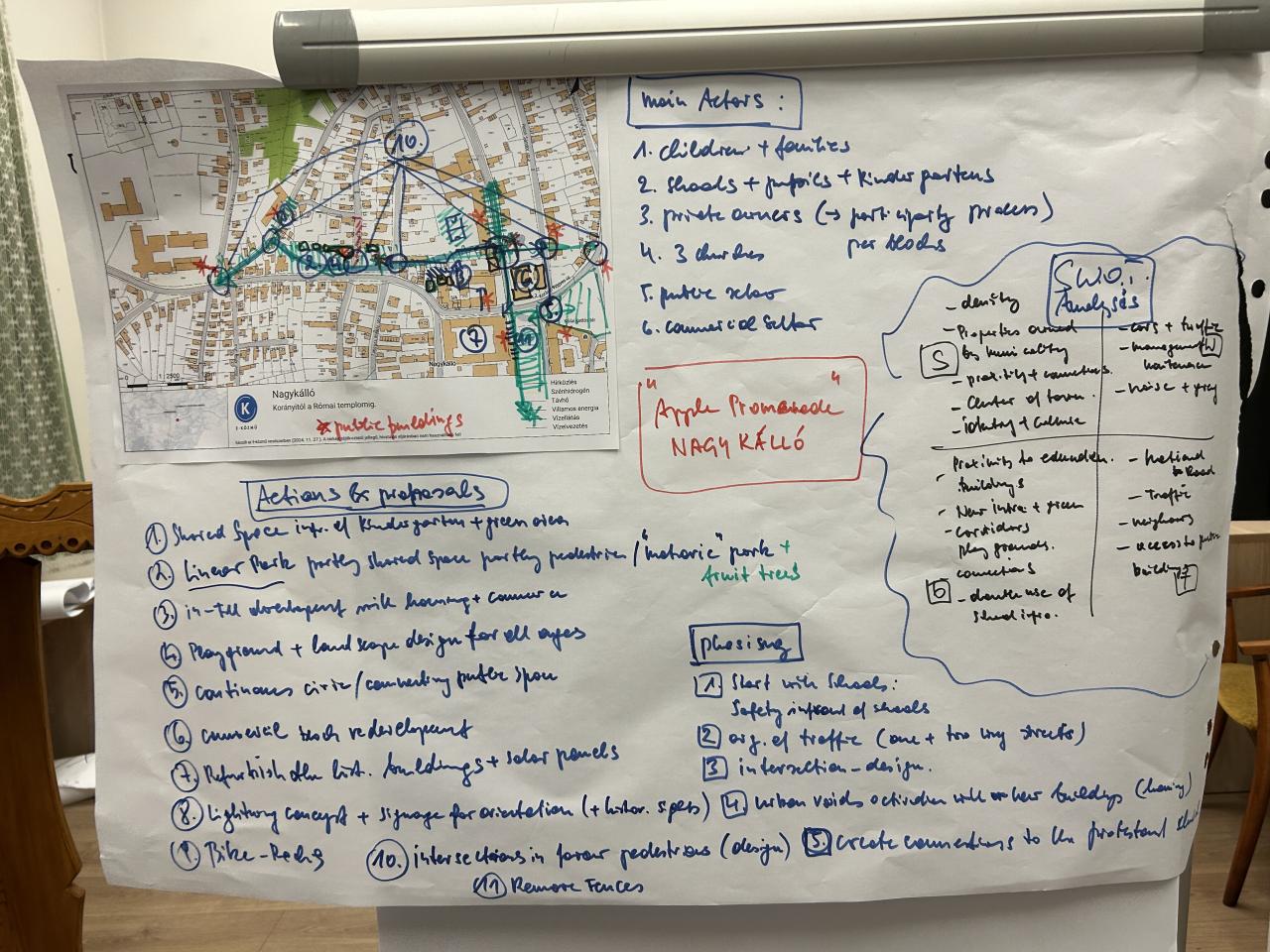
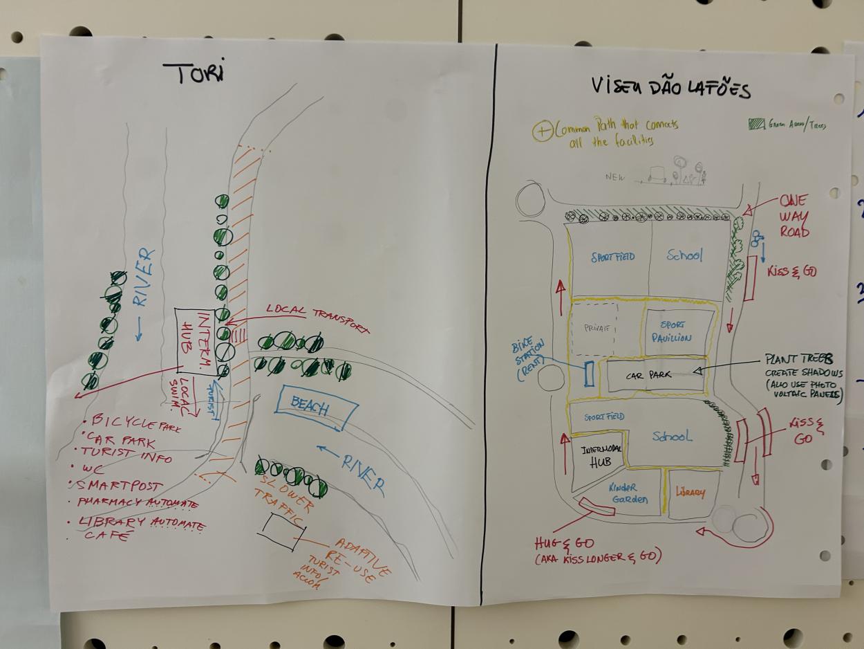
Mapping can literally be done by anyone—children, the elderly, public servants—anyone who wants to express where interventions are needed or analyse the territory. We trained our partners to overcome the initial hesitation of putting the first line on paper and mapping out ideas on how the territory could be developed.
Let’s take emotional mapping as an example. Ask workshop participants where they feel happy, which places they dislike, and which locations should be changed. You will be amazed by the outcome of this spatial analysis of your territory. The collective map, along with the discussion it generates, will reveal insights into where to take action in your city.
Scenario techniques help ease the fear of making mistakes—every idea is valuable, even if it is ultimately excluded from consideration. Mapping strategic scenarios can be very simple, such as creating walkable and bikeable connections in a given territory. Both of these tools work best when used in a group setting, where communication is key to the mapping process.
Mapping serves two main purposes: visualizing data from dialogue-oriented, qualitative co-creative processes and presenting findings from data-driven, quantitative assessments and analyses. Planning professionals can then translate these inputs into accessible visual narratives. Mapping clarifies pathways toward a zero-carbon city region and broadens participation in climate action, making solutions more tangible and actionable.
Make It Simple – Maps Communicate with the Public
Mapping simplifies complex data and abstract policies, rendering them in clear, visual formats that invite engagement and understanding. By transforming extensive data on transportation, active mobility, energy use, land use, and climate risks into accessible visuals, mapping enables stakeholders to comprehend the nuances of urban systems and policies more readily.
Maps help communicate potential outcomes of various planning scenarios, fostering richer engagement among policymakers, urban planners, businesses, and the public. This visual language demystifies urban policies, making it easier to communicate both challenges and opportunities. Importantly, mapping as a tool empowers stakeholders to engage in meaningful discussions on climate adaptation and mitigation strategies, enabling an inclusive process in which diverse voices contribute to reimagining urban transformation. This approach not only helps align stakeholders but also encourages the co-creation of strategies that respond to the unique characteristics and climate needs of the metropolitan area, establishing a shared commitment to sustainable urban futures.
Place-Based Solutions – Where Is Change Needed?
Maps are an essential step toward place-based solutions at the neighbourhood level, where multi-level governance is important in translating regional policies into local action. Local investment can be stalled by unpopular decisions, such as limiting urban sprawl. However, regional policies like intra-municipal collaboration enable regional strategies to be implemented effectively at the local scale.
Aligned with the principles outlined in the Urban Agenda for the EU and the New Leipzig Charter, mapping supports place-based solutions that address specific needs within functional urban areas. These frameworks emphasize integrated, participatory approaches to urban planning, ensuring that policy interventions are tailored to local contexts rather than applying a one-size-fits-all approach.